NYS GIS Association News
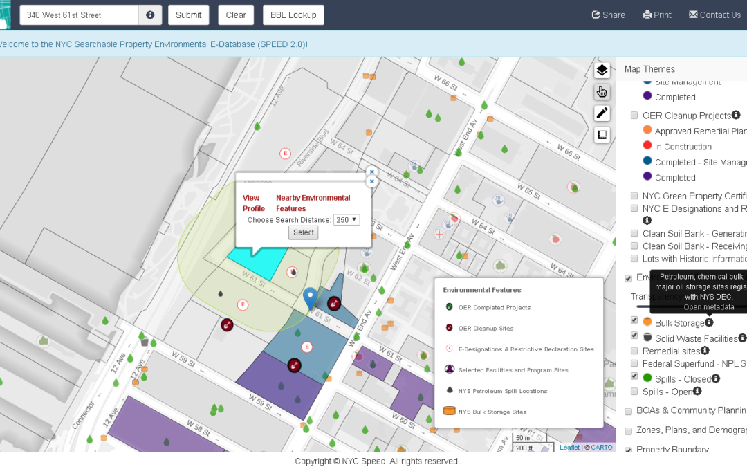
eSpatially – SPEED 2.0: Authoritative Environmental Remediation Mapping in New York City
The latest post from NYS GIS Association member Sam Wear, “SPEED 2.0: Authoritative Environmental Remediation Mapping in New York City", posted June 9, 2021, is available on his website eSpatially New York. "SPEED 2.0 is an impressive collection of local/city, state,...
eSpatially – Taking a Peek Under the Hood: New York State GIS Association
The latest post from NYS GIS Association member Sam Wear, “Taking a Peek Under the Hood: New York State GIS Association", posted May 11, 2021, is available on his website eSpatially New York. "Curbing my own personal thoughts and opinions about where the profession is...
FRANK WINTERS ON MAPSCAPING PODCAST!!!!
Frank Winters, the NYS Geographic Information Officer, recorded a podcast with Daniel O'Donohue, host of the MapScaping Podcast, for the geospatial community. It aired on April 21st and is titled, Access to data - making room for unexpected contributors. They talked...
eSpatially – 10 Questions: Peter Carlo
The latest post from NYS GIS Association member Sam Wear, “10 Questions: Peter Carlo", posted April 27, 2021, is available on his website eSpatially New York. "One of those individuals is Peter Carlo, who works for the New York City Department of Parks and Recreation...
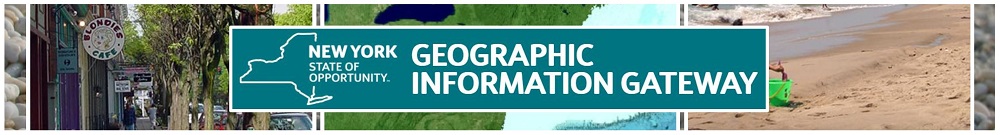
New York OPD Geographic Information Gateway News
News from the Gateway Team FIRST…A REMINDER! If you click a link to the Gateway and see only a blank page with Gateway header and footer, just go to the url in the browser and remove the ”s” from https:// so that it reads http:// (Like this:...
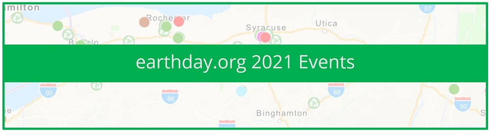
Happy Earth Day 2021!
Locate Earth Day 2021 Events near you at www.earthday.org/earth-day-2021/ Scroll about halfway down the page for the Earth Day Events Map.
eSpatially – Geospatial Student Spotlight: Ge (Jeff) Pu
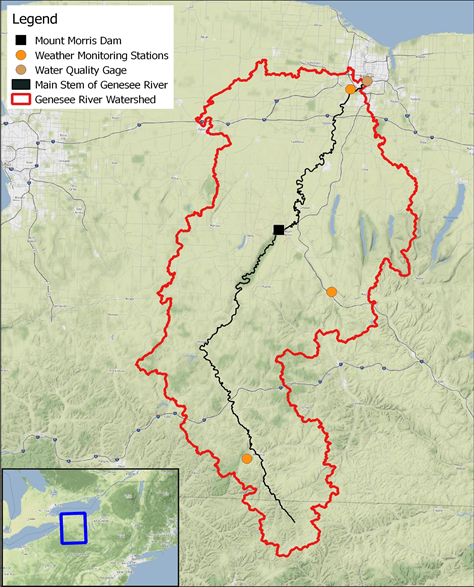
The latest post from NYS GIS Association member Sam Wear, “Geospatial Student Spotlight: Ge (Jeff) Pu”, posted March 24, 2021, is available on his website eSpatially New York. "The Mount Morris gravity dam on the Genesee River was utilized as a separation point when...
eSpatially – Celebrating – and Visualizing – New York State Scenic Byways
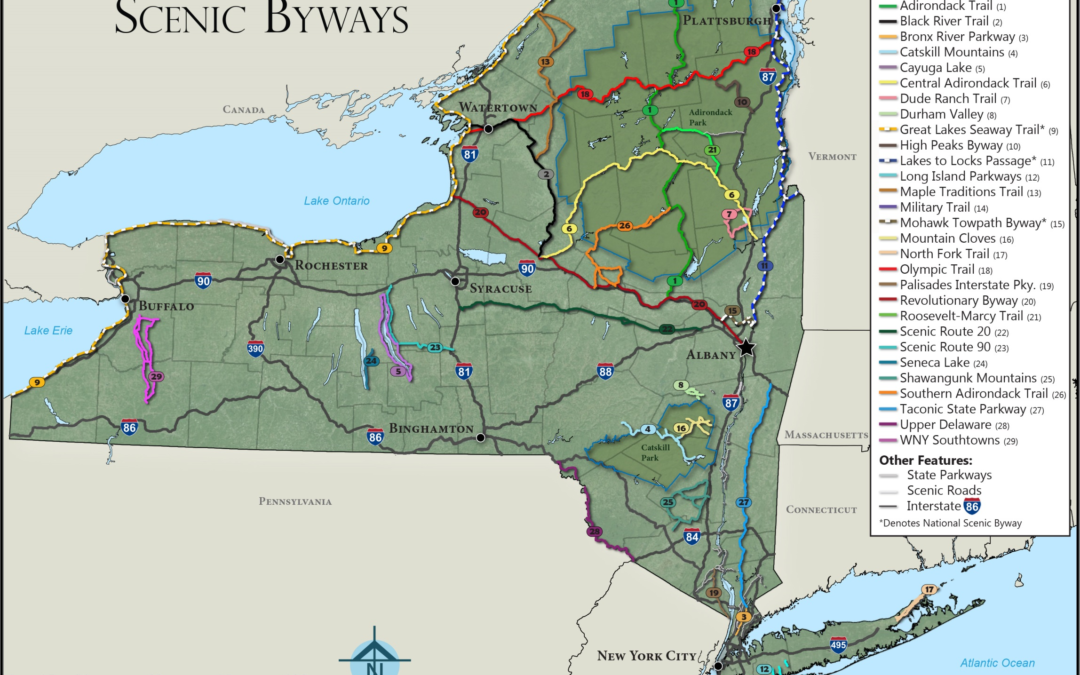
The latest post from NYS GIS Association member Sam Wear, “Celebrating – and Visualizing – New York State Scenic Byways”, posted March 10, 2021, is available on his website eSpatially New York. "Increasingly lost as part of our insatiable appetite for interactive...

GISMO’s Monthly Map Challenge Focuses on Women’s History
Join GISMO’s Monthly Map Challenge Capture this knowledge and more at GISMO’s Women’s History Month Map Challenge. It’s easy. Upload photos and map coordinates of notable Women’s History sites using our online form. Did you know… …that Judge Ruth Bader Ginsburg, who...
Expanded 2020 Orthoimagery & Elevation Service Updates
Hello, We have several exciting announcements about Orthoimagery and Elevation data below. Expanded 2020 Orthoimagery More of the 2020 NY Statewide Digital Orthoimagery Program orthos are available in more ways. The 2020 and Latest web services now include 15 counties...
 Open Source GIS
- Notebooks in QGIS 01/10/2026
- QGIS to (Geo)Pandas – part 3 12/03/2025
- QGIS to (Geo)Pandas follow-up 10/31/2025