Related Posts


The latest post from NYS GIS Association member Sam Wear, “Geospatial Student Spotlight: Ge (Jeff) Pu”, posted March 24, 2021, is available on his website eSpatially New York.
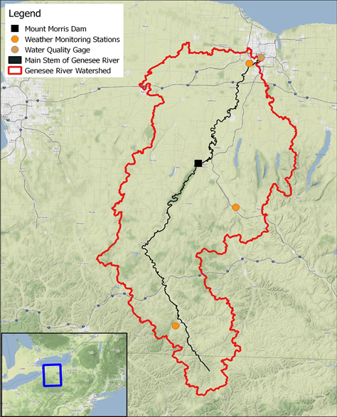
“The Mount Morris gravity dam on the Genesee River was utilized as a separation point when comparing the results of riparian vegetation indices. This separation formed a logical break since upstream of the dam the channel follows its natural path, whereas flow downstream of the dam is regulated by the dam instead of natural flow regimes. An interactive web map of the study area is here.”
You can also follow Sam on Twitter: @eSpatiallyNY