NYS GIS Association News
NYGeoCon Official Website is Now Live!
We are excited to announce the launch of the official website for NYGeoCon 2025, which will be held from October 8-10, 2025 in the scenic Lake Placid! The new website is now live and serves as your go-to resource for all conference details. On the site, you can:...
Daniel Patrick McHugh Obituary
We are sad to hear of the recent passing of former member Daniel Patrick McHugh. His obituary is below. Daniel Patrick McHugh, 77, of Bay Ridge, Brooklyn, New York, passed peacefully on December 17, 2024, in Ooltewah, Tennessee. A wake will be held on January 3,...
New York State Office of Information Technology Services Geospatial Services Unit Receives Federal Funding to Collect LiDAR Data
The New York State Office of Information Technology Services (ITS) has announced that its Geospatial Services (NYS Geo) Office has been awarded $123,000 in Federal funds to collect Light Detection and Ranging (LiDAR) data covering Nassau and Suffolk counties on Long...
espatially – Qntfii & Harkin Work Together to Provide Reality Capture Services and Education to the New York State Geospatial Community
The latest post from NYS GIS Association member Sam Wear, “10 Questions: Elisabetta (Lis) DeGironimo", posted on February 27th, is available on his website eSpatially New York. The two New York State-based firms focus on drone and Lidar technology including SLAM...
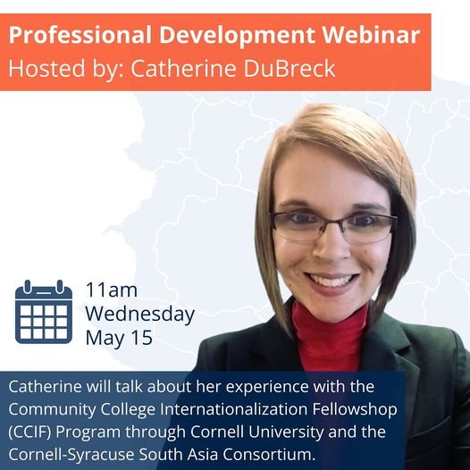
NYS GIS Association May Professional Development Webinar
Speaker: Catherine DuBreck Date and Time: May 15, 2024 at 11:00 AM Topic: Community College Internationalization Fellowship (CCIF) Program Abstract: Catherine DuBreck will summarize her experience with the Community College Internationalization Fellowship (CCIF)...

2024 Westchester County GIS User Group Meeting
Get ready to mark your calendars because the 2024 Westchester County GIS User Group Meeting is near! We are thrilled to invite you to join us on May 16th, 2024, at SUNY Purchase College for a day filled with insightful presentations, networking opportunities, and...
espatially – 10 Questions: Elisabetta (Lis) DeGironimo
The latest post from NYS GIS Association member Sam Wear, “10 Questions: Elisabetta (Lis) DeGironimo", posted on February 27th, is available on his website eSpatially New York. Earlier this month it was announced that Lis DeGironimo was appointed New York State’s...
espatially – 5 Barriers to Building GIS Programs in Small Governments in New York State
The latest post from NYS GIS Association member Sam Wear, “5 Barriers to Building GIS Programs in Small Governments in New York State", posted on January 16, is available on his website eSpatially New York. Helping connect geospatial to the programs they fund and how...
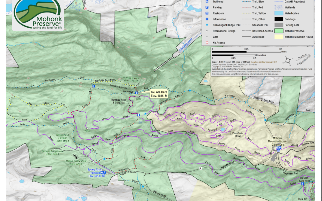
espatially – GIS and Mapping Activities at Mohonk Preserve in the Shawangunk Mountains
The latest post from NYS GIS Association member Sam Wear, “GIS and Mapping Activities at Mohonk Preserve in the Shawangunk Mountains", posted on November 28, is available on his website eSpatially New York. "While traditional trail maps (hardcopy and digital) are...

Learn a New Tool for Working with Maps!
Felt Webinar for Educators How to Leverage Free Mapping Tools in the Classroom 6 December 2023, Wednesday, at Noon EST Catherine DuBreck, GISP, a lecturer at the Rochester Institue of Technology is presenting a webinar on Felt. She will be sharing her experience with...
 Open Source GIS
- Notebooks in QGIS 01/10/2026
- QGIS to (Geo)Pandas – part 3 12/03/2025
- QGIS to (Geo)Pandas follow-up 10/31/2025