Related Posts

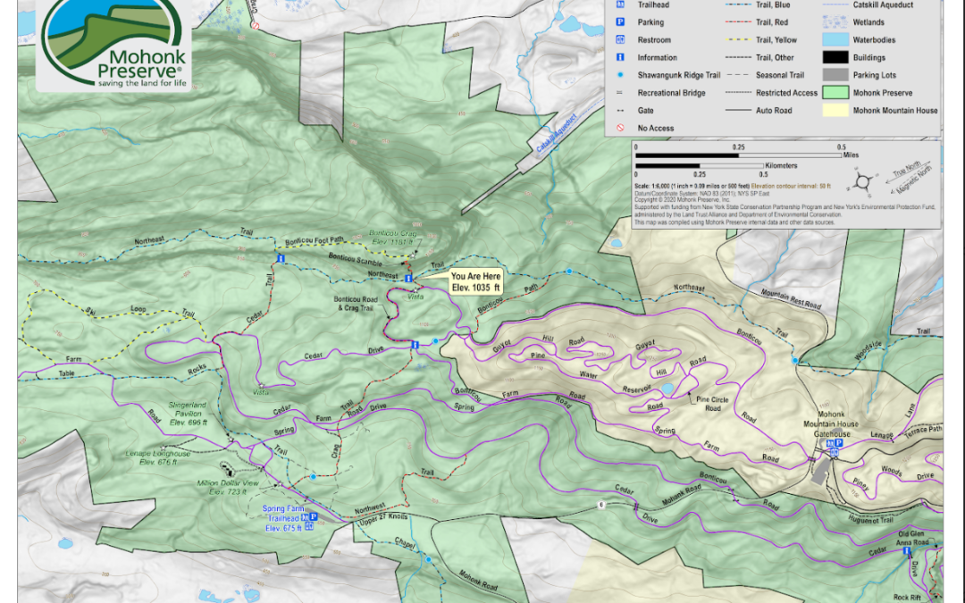
The latest post from NYS GIS Association member Sam Wear, “GIS and Mapping Activities at Mohonk Preserve in the Shawangunk Mountains”, posted on November 28, is available on his website eSpatially New York.
“While traditional trail maps (hardcopy and digital) are still paramount and important, Mohonk Preserve uses GIS for environmental and facility management purposes as well.”
Mapping and GIS are integral parts in all aspects of managing the built and natural environment at Mohonk Preserve” notes Pestone. He adds “In the future we see expanding use geospatial technologies by both seasonal and full-time staff and with our collaborating agencies. I anticipate no shortage of uses and applications.
You can also follow Sam on Twitter: @eSpatiallyNY
Image Source: https://espatiallynewyork.com