Related Posts


The latest post from NYS GIS Association member Sam Wear, “Focus on Hudson River Flooding Impacts”, posted August 26, 2020, is available on his website eSpatially New York.
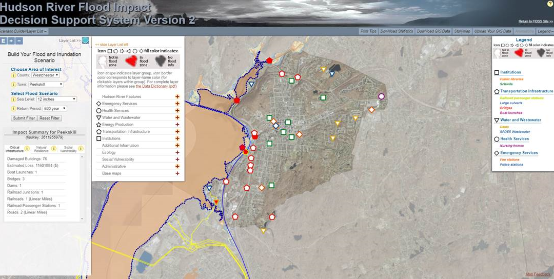
“The Hudson River Flood Impact Decision Support System (HRFIDSS) is an online mapping application as well as a collection of geospatial products and data which illustrate the scale of potential flooding for tidally-affected shorelines of the Hudson River Valley and Westchester County coastal communities.”
You can also follow Sam on Twitter: @eSpatiallyNY