NYS GIS Association News
eSpatially – Mapping a New Economy for Equality and Sustainability
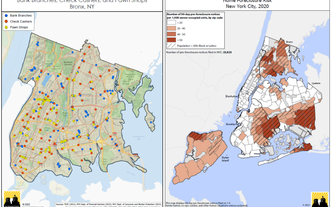
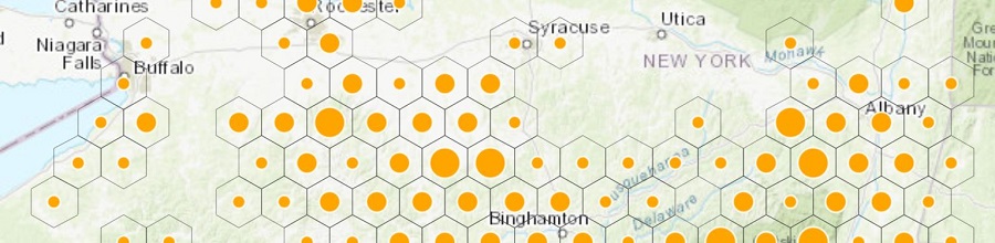
The latest post from NYS GIS Association member Sam Wear, “Mapping a New Economy for Equality and Sustainability", posted March 8, 2022, is available on his website eSpatially New York. "(Left Image): Bank branches are not distributed and made accessible evenly across...
GISCI Announces GISCI Endorsement Designation
FOR IMMEDIATE RELEASE: GISCI Announces GISCI Endorsement Designation Des Plaines, IL (March 3, 2022) The GIS Certification Institute (GISCI) has created the GISCI Endorsement Designation Program to help increase the value of GISP Certification for our primary...
GISMO to Hold General Membership Meeting on March 2nd
General Membership Meeting Agenda Wednesday, March 2, 2022 5:00 pm – 6:00 pm Link: https://us02web.zoom.us/meeting/register/tZctfu-prjgtH9P8rQgaWMPvXpNe-oarDeRM Tentative Agenda: I. Welcome members and introduce board II. Meet Tom Swanson, Citywide GIS Director,...

GIS/SIG Announces 2022 Conference!
GIS/SIG 2022 Conference Scheduled for April 5th GIS/SIG is happy to hold the 2022 GISSIG in person this April 5, 2022, at the RIT Inn and Conference Center. The format will be a little different due to Covid; it will be a single track of speakers....
The Professional Development Committee Announces March Webinar!
Join the Professional Development Committee for a Webinar on Thursday, March 24th at Noon Meeting Workforce Needs with Virtual GIST: The story of one community college’s quest to create remote access to GIST education in Upstate New York. Registration link:...
eSpatially – Campus Planning and Geospatial Technologies at UAlbany
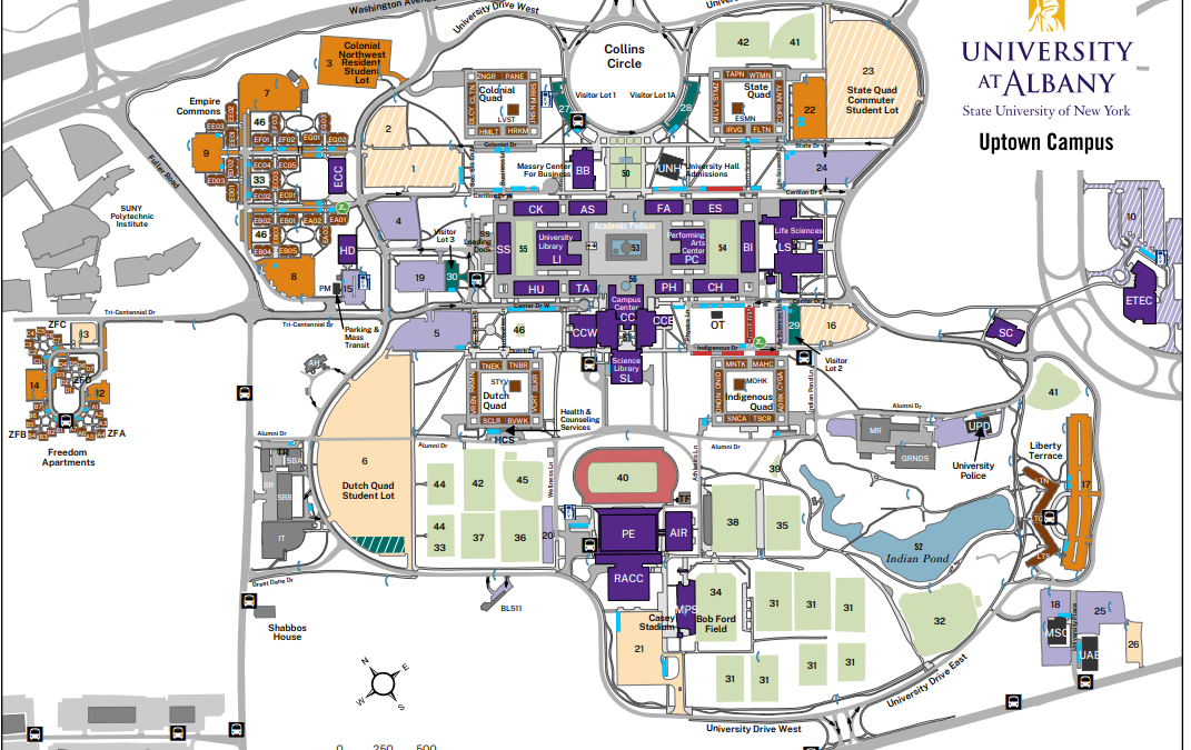
The latest post from NYS GIS Association member Sam Wear, “Campus Planning and Geospatial Technologies at UAlbany", posted February 16, 2022, is available on his website eSpatially New York. "Large campus facilities such as SUNY Albany bring together the intersection...
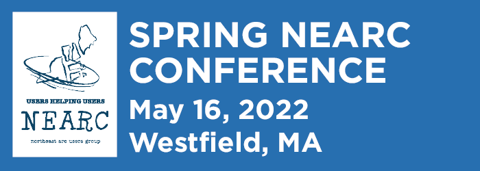
SPRING NEARC CALL FOR ABSTRACTS
SPRING NEARC CALL FOR ABSTRACTS Spring NEARC is an annual, one-day conference packed with professional development and networking opportunities for all levels of GIS users. We invite you to join us for an in-person reunion at Westfield State University in Westfield,...
GISCI Announces Exam Dates: 4 -11 June 2022
FOR IMMEDIATE RELEASE Des Plaines, IL (February 15, 2022) The next testing window for the GISCI Geospatial Core Technical Knowledge Exam® as a part of the GISP Certification has been scheduled and will once again be administered by PSI Online through their worldwide...
Join the HWA Winter Mapping Challenge!
Join the Hemlock Woolly Adelgid Winter Mapping Challenge Did you know that winter is the best time to check for hemlock woolly adelgid (HWA)? You can help monitor this invasive species, particularly along the “leading edge” of the distribution that runs across the...
Columbia Announces GIS Health Data Workshop
Mark your calendar for the GIS Health Data Workshop on June 27-28, 2022 led by experts at Columbia University! GIS Workshop: Visualizing and Analyzing Health Data: A two-day intensive workshop that will introduce participants to the fundamental concepts and...
 Open Source GIS
- Notebooks in QGIS 01/10/2026
- QGIS to (Geo)Pandas – part 3 12/03/2025
- QGIS to (Geo)Pandas follow-up 10/31/2025