Related Posts

The latest post from NYS GIS Association member Sam Wear, “Mapping a New Economy for Equality and Sustainability”, posted March 8, 2022, is available on his website eSpatially New York.
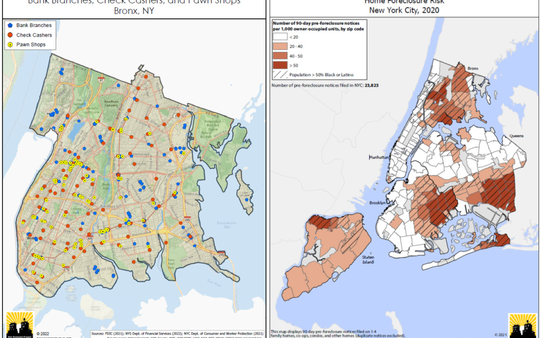
“(Left Image): Bank branches are not distributed and made accessible evenly across the city. This map depict the relative absence of bank branches in the Bronx, and the resulting concentration of high-cost alternatives such as check cashers and pawn shops. This is a series of maps that NEP updates every year covering most (if not all) of the city’s neighborhoods. (Right Image): NEP creates maps showing the concentration of residential foreclosure risk in NYC communities of color. This uses data from the NYS Dept. of Financial Services, based on notices that mortgage servicers are required to send to delinquent borrowers 90 days before initiating a foreclosure action. While not all of these notices result in an eventual foreclosure, it provides a good indication of where the risk of home foreclosure is highest in the city.”
You can also follow Sam on Twitter: @eSpatiallyNY