Related Posts


The latest post from NYS GIS Association member Sam Wear, “COVID Era Geospatial Applications to Support Empire State Communities”, posted July 1, 2020, is available on his website eSpatially New York.
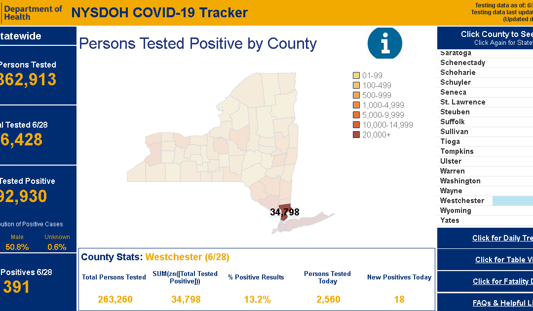
“NYS Department of Health (DOH) COVID-19 reporting has improved dramatically since the pandemic appeared in March. Though while numbers are made available only on a county basis, users can access and visualize the data in a variety of ways. Reporting and posting of the data has become much more timely. DOH is also now publishing a regional “Early Warning Monitoring Dashboard“.”
You can also follow Sam on Twitter: @eSpatiallyNY