NYS GIS Association News

Building Next-Generation Mapping Applications with Open Source Spatial Tools Webinar (Feb 6)
The New York State GIS Association invites you to attend an upcoming webinar “Building Next-Generation Mapping Applications with Open Source Spatial Tools” presented by Chris Whong on Wednesday February 6, 2019. Mr. Whong is an urbanist, mapmaker, data junkie, and...
Mapping Hard to Count Communities for a Fair and Accurate 2020 Census Webinar (Jan 30)
The New York State GIS Association invites you to attend an upcoming webinar “Mapping Hard to Count Communities for a Fair and Accurate 2020 Census” presented by Steven Romalewski on Wednesday January 30, 2019. Mr. Romalewski directs the Mapping Service at the Center...
Cool New GIS Tools and Data Webinar NOW AVAILABLE on YouTube!
The NYS GIS Association is pleased to announce that the Dec 18, 2018 webinar "Cool New GIS Tools and Data from the NYS GIS Program Office" as part of the 2018-2019 Webinar Series is available to view on our YouTube channel! Title: Cool New GIS Tools and Data from the...
Upcoming NYS GIS Association Webinars (Jan 23, Jan 30, Feb 6)
The New York State GIS Association invites you to attend our upcoming webinars! You have three chances over three weeks to attend a FREE webinar! Join us on Jan 23, Jan 30, and Feb 6! UPDATE: The Digging Into Census ACS Data webinar has been cancelled. Date:...
Geographic Information Gateway (Gateway) News: Effects of Government Shutdown, Current Status, A Fond Farewell and Some Metrics
Happy New Year! Hope you had a fantastic holiday season! Impact of the Government Shutdown As you may know, the Gateway provides geospatial information from a number of different sources: we host a large chunk of the data ourselves on the same cloud server that hosts...

Announcement of 2019 NYSGPO Collection in New York State
The New York state GIS Program Office (NYSGPO) is pleased to share news that we plan to collect Quality Level 2 LiDAR data that will cover all or parts of three counties (Erie, Genesee, and Livingston) in NY, replacing three LIDAR-derived datasets. This project is...

President’s Message
Rick Reichert, he new president of the NYS GIS Association has a message for you! Read about his plans for the coming year.
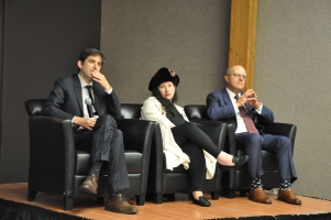
GeoSummit 2018 Pictures
Check out the pictures from the 2018 GeoSummit. Many, many thanks to Lindi Quackenbush for her wonderful photography.

NYGeoCon 2019 – Save the Date!
What: 2019 NYGeoCon When: September 23-25, 2019 Where: Marriott Syracuse Downtown, Syracuse NY How to Register: Registration will open in the Summer of 2019! More information: Website available soon What is NYGeoCon? For over 30 years Geospatial Professionals from...

Let’s Get Social for the 2018 GeoSpatial Summit!
Have you started liking and following the NYS GIS Association's social media accounts? If not, what are you waiting for?! Tomorrow (September 25, 2018) is the 2018 GeoSpatial Summit, so now is the perfect time to like and follow us! We will be posting photos and...
 Open Source GIS
- Notebooks in QGIS 01/10/2026
- QGIS to (Geo)Pandas – part 3 12/03/2025
- QGIS to (Geo)Pandas follow-up 10/31/2025