Teacher Resources
Useful websites or data sets for teaching
The NYS GIS Association’s Education Committee has compiled a list of resources as a service to teachers.
Resources from the NAGT (National Association of Geoscience Teachers): https://nagt.org/index.html
GIS-specific resources from the NAGT: https://nagt.org/nagt/search_nagt.html?search_text=GIS&search=Go
National Geospatial Technology Center for Excellence: https://www.geotechcenter.org/education.html
Resources from SERC (Science Education Resource Center): https://serc.carleton.edu/index.html
GIS-specific resources from SERC: https://serc.carleton.edu/teachearth/search.html?search_text=GIS
University Consortium for Geographic Information Science: https://ucgis.memberclicks.net/
Resources from Geographer Joseph Kerski:
- Our Earth YouTube Channel: https://www.youtube.com/user/geographyuberalles
- Lessons Using Public Domain Data: https://learn.arcgis.com/en/paths/the-gis-guide-to-public-domain-data-learn-path/
- Spatial Reserves Blog: https://spatialreserves.wordpress.com/welcome/
- Modern Strategies for Finding Geospatial Data: https://spatialreserves.wordpress.com/2020/09/21/strategies-for-finding-geospatial-data/
Esri’s Learn ArcGIS: https://learn.arcgis.com/en/
How to set up ArcGIS Online in K-12 Schools: https://esriurl.com/funwithgis295
MappingSupport.com, a regularly updated curated list of web servers that host GIS information: https://mappingsupport.com/p/surf_gis/list-federal-state-county-city-GIS-servers.pdf
Shane Bradt’s MapASyst, a community dedicated to geospatial technology education and outreach: https://www.mapasyst.org/
BetaNYC, a website with civic design, technology, and data resources for improving the lives of New Yorkers: https://beta.nyc/
Maptime, an open learning environment focused on mapping: http://maptime.io/about/
Story Maps:
- Water – Food – Energy – Energy Ecosystems Nexus Approach Story Map that includes the UN’s Sustainability Development Goals: https://grid-arendal.maps.arcgis.com/apps/Cascade/index.html?appid=7101ef4dfcfb40e98cdc31b2e9d7da10
- United Nations Sustainable Development Goals Report 2019 Story Map: https://undesa.maps.arcgis.com/apps/MapSeries/index.html?appid=48248a6f94604ab98f6ad29fa182efbd
New York View is one of many StateView members of AmericaView, a nationwide program (a consortium of state-based consortia) that focuses on satellite remote sensing data and geospatial technologies in support of applied research, K-16 education, workforce development, and technology transfer. AmericaView is administered through a partnership between the US Geological Society (USGS) and AmericaView Inc.: https://www.esf.edu/nyview/
NASA’s Remote Sensing Training: https://appliedsciences.nasa.gov/what-we-do/capacity-building/arset
Teaching Tips for Online or Remote Learning Classes
The NYS GIS Association Education Committee has a few tips for teaching in times of COVID:
- Reach out to alumni and ask them to be online mentors either through Zoom or email. Require students to meet with them at least once a semester.
- Set up virtual “Ask Me Anything” sessions with alumni of your program. Beforehand, students could be asked to provide two questions. The list of questions would be given to the alumni 24 hours in advance, and then the event goes live (via Zoom). Students can also ask questions via Zoom/chat. Students receive credit for the event by taking a screenshot, summarizing what they learned, and describing how they think it will affect their future plans.
- Public/college librarians are trained in basic GIS and geospatial data. Students can reach out to librarians for assistance with finding geospatial data for their class projects. This approach was been online in the Fall of 2021 and it went well. It could be implemented face-to-face.
Other Resources
Podcasts
These podcasts offered by the education committee are discussions with folks using GIS. The idea is to interview a diverse range of people who use GIS in their work, whether or not their studies focused on GIS, and to find out how they got where they are, and how GIS plays a role in their work.
 Susan Hoskins is a Senior Extension Associate in the School of Integrative Plant Science Soil and Crop Sciences Section at Cornell College of Agriculture and Life Sciences. She is interested in Geographic information systems (GIS), remote sensing, and Wetlands mapping. Among her many outreach projects are those focused on teaching and mentoring within 4H.
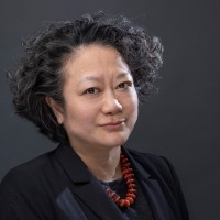
 Jiin Wen works for the NY City Economic Development corporation but her background is in architecture and Urban Planning. She has a wide range of interests that she will share with us.
 Joseph Kerski, winner of the 2021 Lifetime Achievement award in GIS Education from the University Consortium for Geographic Information Science, is a geographer focused on Geographic Information Systems (GIS) in education. He has served as the President of the National Council for Geographic Education and has served as geographer in 4 sectors of society, including government (NOAA, US Census Bureau, USGS), academia (University of Minnesota, Harrisburg Area Community College, Penn State University, Sinte Gleska University, University of Denver, others), private industry (as Education Manager for Esri), and nonprofit organizations (with roles in geography and education associations).
Story Map Resources (K-12)
- Writing accessible StoryMap content
- ArcGIS+StoryMaps
- What’s new in ArcGIS StoryMaps (September 2020)
- What’s new in ArcGIS StoryMaps (June 2020)
- What is an express map and why should you use one?
- National Geographic’s StoryMap of the changes in water balance after 20 years on planet Earth
- Tips on using the ArcGIS StoryMaps theme builder
- Take your stories and collections anywhere by embedding them
- Quick tips for mastering the ArcGIS StoryMaps builder
- Planning and outlining your StoryMap: How to set yourself up for success
- Nine steps to great storytelling
- How web map bookmarks benefit ArcGIS StoryMaps
- Getting started with ArcGIS StoryMaps (Tutorial)
- Get started with ArcGIS StoryMaps by building a story map about a scientific expedition to a Guatemalan volcano
- Get to know ArcGIS StoryMaps
- Expand your storytelling horizons with explorer tour
- Employing, and enjoying, sidecar’s docked and floating panel layouts
- Crowdsourced mapping for ArcGIS StoryMaps: Easy as 123
- Create a standout story with ArcGIS StoryMap’s design panel
- Breaking the sound barrier in ArcGIS StoryMaps
- A guide to working with images in ArcGIS StoryMaps
