GeoSpatial Summit 2016 Review
The GeoSpatial Summit 2016 began with welcome remarks by Kate Kiyanitsa where she expressed a huge thank you to all the Summit sponsors and the NYU for the use of the hall.
D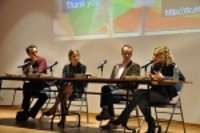 r. Christopher Tucker, Chair-Elect of the American Geographical Society, kicked off the Summit by speaking about the Internet of Things (IoT) and how our only hope may be for robots to decipher the vast amounts of IoT data generated, and convey this data to humans in the form of stories. Humans will have to train these robots about our values and interests so that the stories that are conveyed are meaningful. Since events happen at a certain location at a certain time, the data will be spatial-temporal in nature, and those working in geospatial technologies are critical in this evolution. He asked us to think about how robots will communicate with us and recommended the movie Eagle Eye.
Arnaud Sahuguet, Director of the Foundry @ Cornell Tech, spoke about the collaboration between Cornell University and Technion (Israel) at the new center being built on Roosevelt Island in NYC. He presented ideas in groups of three for the audience to consider. He brought up subjects such as: big data vs. small data; privacy for other species (to protect endangered species from poachers); why z-axis coordinates are very important, especially in cities; and the eBird crowd-sourced bird species tracking site. He concluded with reasons why he believes that GIS is more important than ever.
Joseph Hlady, from Civil Maps, educated the audience about autonomous vehicles (AV) and how they are driving a new way of mapping. He explained how LiDAR has moved beyond terrain modeling and is becoming part of industrial sensor platforms for surveillance and in real-time navigation and collision avoidance systems. In the future we will crowd source street data using LiDAR on all cars and the design of our cities will evolve once we rely on AV. LiDAR is currently being used for low-cost infrastructure data collection. Joseph recently completed a project to collect LiDAR data for a pipeline project. The LiDAR was collected and processed for $100/km! He told us that real-time LiDAR feature extraction is in our future — it’s a new era in mapping!

Laura Bliss spoke about Hull House and the maps made by Jane Addams that showed the demographics of the working poor in the Hull House area in Chicago. Women have been active in cartography for many, many years but have often not been credited. These maps clearly showed the demographic distribution of the poor in this area. Laura was then joined on stage by Alyssa Wright, from Mapzen, for further discussions of women in cartography.
Kevin We bb’s topic was “Data in the public interest.” Kevin, who’s with Sidewalk Labs, introduced the idea that data in the public interest “is about the assignment and discussion of rights.” He went on to say that “historically we had data producers and data users, and that line is disappearing. “ Kevin talked about public vs private data in the public interest, bringing up Apple’s privacy policy. The idea of data utilities – data provided and consumed much like other utilities, gave the audience an idea to ponder as we enter a new era of open data.
Andrew  Turner left the audience with many ideas to think about. This rocket scientist turned neogeographer is Director and CTO of the Esri Research and Development Center in Washington, DC. While discussing the role of open data in society, Andrew talked about the world as a fractal – the more we zoom in, the more complexity is revealed; and the city as a living system. Public information infrastructure and GIS as an infrastructure was another theme woven through his discussion of data-driven citizenship. User experience matters, and Andrew envisions a future where we interact with open data through a vocal interface and where open data enriches our lives.
 Join or renew for 5 years!
 Join Us!
$10 Professionals/
Member Login
Map of Members
Store
Our YouTube Channel