Speakers
Anne Hale Miglarese | Jim Geringer | Ronald
Beck |
Art Kalinski
Adam Szofran | David Miller |
Adena Schutzberg
Agenda
 Anne Hale Miglarese is a principal with the Booz Allen Hamilton
consulting firm in Washington, D.C. She
directed remote sensing and GIS programs for ten years as chief of the
Coastal Information Services branch of the National Oceanic and
Atmospheric Administration's (NOAA) Coastal Services Center.
Miglarese's career began in the private sector as an environmental
consultant and regulatory compliance specialist for the Clean Water
and National Environmental Policy Acts. She also worked for numerous
South Carolina agencies, including the Department of Health and
Environmental Control, the Water Resources Commission and the
Department of Natural Resources. Most recently, she was the president and managing
director of Fugro EarthData, a company
specializing in airborne mapping, remote sensing and GIS services. Miglarese
also serves on numerous boards, including the Management Association of Private
Photogrammetric Surveyors and and an editorial board member of GeoSpatial
Solutions. Miglarese is the chairperson
of the National Geospatial Advisory Committee.
She was a founding member of the National States Geographic Information Council, a past chairwoman of the South Carolina State Mapping Advisory Committee, a previous board member of the Urban and Regional Information Systems Association and currently serves of the board of MAPPS and as co-chair of the NSGIC corporate leadership council. Miglarese is active in national policy governing spatial data, serving as past chairman of the Federal Geographic Data Committee's Marine and Coastal Spatial Data Subcommittee. She represents the United States Department of Commerce on the Civilian Application Committee.
Miglarese holds a B.S. and M.S. in geography from the University of South Carolina.
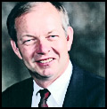 Jim Geringer, Wyoming Governor 1995-2003, Director, Policy and Public Sector
Strategies, Environmental Systems Research Institute (ESRI)
Jim Geringer, a native of Wheatland, Wyoming, earned his B.S. in Mechanical Engineering from Kansas State University. Mr. Geringer served as a project officer on unmanned space programs for the Air Force for NASA, including the Global Positioning Satellite System, early detection/warning systems, the Interim Upper Stage for the Space Shuttle and the Mars Viking Lander, activation of the Peacekeeper missile system and disaster recovery from nuclear, biological and chemical warfare.
Mr. Geringer served the Wyoming Legislature from 1983 to 1994, including six years each in the House and the Senate. Committee chairmanships included Appropriations, Judiciary and Management Audit. He was first elected as Wyoming Governor in 1994 and reelected in 1998. Mr. Geringer focused on improving education through standards, accountability and technology, modernized economic planning to extensively include technology, changed how natural resource agencies among state, federal and local governments worked together, implemented strategic planning tied to performance based budgeting and upon leaving office, provided Wyoming state government with a budget surplus, one of very few states to make that claim early in 2003. In addition, he emphasized community based solutions particularly for health and social services and promoted the use of consensus building to resolve difficult issues.
Mr. Geringer has served on the GeoSpatial One Stop Board of Directors, National Commission on Mathematics and Science Teaching for the 21st Century, the National Commission on Service-Learning, the National Commission on Teaching and America's Future, chair of the National Governors Association Technology Task Force and as charter member and current Chair of the Board of Trustees, Western Governors University.
Currently, Mr. Geringer is a member of the Mapping Sciences Committee under the National Academy of Sciences National Research Council; Western Interstate Energy Board ; Association of Governing Boards for higher education; Operation Public Education; the Board of Governors of the Park City Center for Public Policy; Board member of NatureServe and, co-chair of the Policy Consensus Initiative.
Mr. Geringer joined Environmental Systems Research Institute (ESRI) in the summer of 2003 as Director of Policy and Public Sector Strategies, focused on how senior elected and corporate officials can enable productivity through technology more effectively in business and government. ESRI, the world leader in location based software and applications, is headquartered in Redlands, California.
 Ronald
Beck is a Program Information Specialist in the Land Remote Sensing
Program in the U. S. Geological Survey (USGS.) His primary responsibility
is to work with sister federal agencies, especially NASA, as the USGS prepares
for the next generation of earth observing satellites.
Beck was born and raised in Sioux Falls, SD, graduated from Washington High School in Sioux Falls and has B.A. and M.A. degrees from the University of South Dakota.
He taught one year at the University of South Dakota and 7 years at Briar Cliff College, Sioux City, Iowa, serving for two years as Chairman of the colleg's English Department.
In 1974 he joined the contractor staff at the U.S. Geological Survey's EROS Data Center in Sioux Falls. From 1974 through May of 2005 he held a number of positions at the Center, working for various contractors and for the USGS. He was one of the organizers of the "Earth as Art" exhibition, an exhibition which was recognized in 2003 by the most prestigious communications award granted by the U.S. Geological Survey, the Shoemaker award.
In June, 2005, he transferred to Reston, Virginia to USGS headquarters to work on policy and communications issues for the satellite programs. While there he was the sponsor and advocate for the USGS on the Smithsonian's "Earth From Space" exhibition. That exhibition is on a four year tour and will be seen by an estimated 3.5 million people. In November, 2007 he returned to Sioux Falls and EROS as point of contact for Headquarters for satellite imagery and information issues.
Art
Kalinski, GISP
A career Naval Officer, Art established the Navy's first GIS in the mid-eighties and used it to complete the 1987 military base closure study. GIS proved to be such a powerful tool that Art pursued a GIS career after retiring from the Navy. Upon completion of GIS graduate work at the University of North Carolina, he joined the Atlanta Regional Commission (ARC) serving as the GIS Manager from 1993 to 2007. He was an ESRI software instructor and was in the first group of GIS professionals to receive certification as a GISP. More recently he pioneered the use of oblique imagery in the Atlanta Region for public safety and Homeland Security applications. Art retired early from ARC to join Pictometry International to direct military projects using oblique imagery. He also writes a monthly column for GeoSpatial Solutions aimed at federal GIS users.
Adam Szofran is a senior software engineer at Microsoft. For the past ten
years he has been a member of the teams that have produced the hit series of
simulation games such as Microsoft Flight Simulator, Combat Flight Simulator,
and Train Simulator. Adam specializes in terrain rendering and he enjoys finding
new ways to incorporate geospatial data into Microsoft's simulation games.
Adam is an aviation enthusiast, a licensed private pilot, and a former aircraft
owner. In his free time, he enjoys biking, kayaking, and hiking in the Seattle
area and spending time with his wife and baby girl.
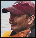 Dr.
David Miller, Dr. David Miller is a Distinguished Teaching Professor
of Geography at SUNY Cortland. He has been teaching GIS courses for more
than 15 years, is an ESRI Authorized GIS instructor, and has written articles
for ArcUser magazine. An outdoorsman, he is an expert walleye
fisherman and is a
member of the National Association for Search and Rescue.
In late May of 2002, after a winter sabbatical focused on reading the Journals of Lewis and Clark, and pouring over maps and gathering information about the Missouri River, Dr. Miller began what evolved into a three summer-long solo expedition down the Missouri River in his 17' long sea kayak. Over the course of three summers, he paddled the entire river, from the headwaters in western Montana to the confluence with the Mississippi, and then down the Mississippi to the Arch at St. Louis. Officially he paddled 2,321 miles; his average speed was not quite 3 miles per hour. He is the author of the book, The Complete Paddler: A Guidebook for Paddling the Missouri River from the Headwaters to St. Louis, Missouri, published by Farcountry Press.
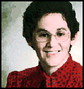 Adena Schutzberg is Executive Editor of Directions Magazine and contributes
to its widely-read weekly electronic newsletters and website. Before joining
Directions Magazine, Schutzberg founded and edited GIS Monitor for nearly five
years.
She is also the Principal of ABS Consulting Group, Inc., a GIS consulting firm providing services to clients including GIS software, data and imagery companies.
Before opening her own company, Schutzberg headed U.S. operations for UK-based Cadcorp, and held several positions at ESRI over eight years. She began her career heading Arthur D. Little's CAD/GIS lab and teaching college geography. She holds a BA in Chemistry from the University of Chicago and an MS in Geography from Pennsylvania State University.