 Grant
Grant
The US Geospatial Intelligence Foundation
Makes the 2011 NYS GeoSpatial Summit a Reality!
For the first time ever, the NYS GeoSpatial Summit has received a grant from the US Geospatial Intelligence Foundation (USGIF). This grant has enabled the Summit to be held in 2011! It has also allowed it "roll back" the registration and sponsor prices to our 2008 levels to encourage a broad participation in the Summit by geospatial practitioners and students across New York.
For those who are not familiar with the USGIF, they invite you to learn more through their website: http://usgif.org/. The purpose of the USGIF is to promote the geospatial intelligence tradecraft and to develop a stronger community of interest between government, industry, academia, professional organizations and individuals who share a mission focused around the development and application of geospatial intelligence to address national security objectives.
Toward this end, the Foundation seeks to accomplish broad objectives:
- To sponsor, conduct and support public discussion groups, panels, lectures and forum, to which will be invited members of the public, scientists, governmental leaders and others for an interchange of views and the instruction of the public on the topics under review.
- To publish and distribute educational publications relevant to civic associations, governmental bodies, libraries, schools, universities and other interested groups (educational activities shall be designed and presented in a manner that will enable the listener or reader to draw his or her own conclusions) In doing so, the Foundation shall not espouse policies of positions the accomplishment of which may only be achieved by the passage or defeat of legislation.
- To conduct sponsor or promote educational programs including, but not limited to, programs for teachers, administrators and students.
- To award scholarships to students at accredited institutions of higher education to pursue geospatial intelligence disciplines, to include such areas as: geographic information systems, remote sensing, intelligence analysis, and other related topical areas.
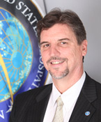
Max Baber is Director of Academic Programs at the United States Geospatial Intelligence Foundation (USGIF), managing accreditation of university Geospatial Intelligence (GEOINT) certificate programs and supporting related academic initiatives. Dr. Baber received a Ph.D. in Geography from the University of Georgia in 1999 and an M.A. in Geography from Georgia State University in 1993. He has served in faculty appointments with the Master of Science in Geographic Information Systems program at the University of Redlands and Departments of Geography at Samford University and the University of Northern Colorado. He has developed and implemented a number of pedagogical geographic information science projects supported with funding from a number of sources including the National Science Foundation. He is a member of the U.S. National Committee for the International Cartographic Association (USNC-ICA), serves on the board of directors for the Cartography and Geographic Information Society (CaGIS), and is a Fellow of the British Cartographic Society (BCS).